La dent du Chat

JacouBrijou
User
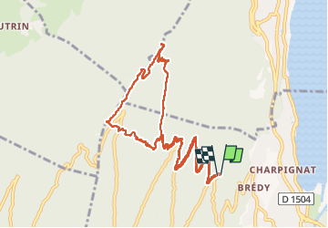

Length
12.8 km

Max alt
1468 m

Uphill gradient
908 m
Km-Effort
25 km

Min alt
607 m

Downhill gradient
901 m
Boucle
Yes
Creation date :
2022-05-01 07:30:29.001
Updated on :
2022-05-01 15:25:56.524
7h53
Difficulty : Difficult

FREE GPS app for hiking
 SityTrail
IGN / Geographical institutes
SityTrail Plus
The world is yours!
About
Trail Walking of 12.8 km to be discovered at Auvergne-Rhône-Alpes, Savoy, Le Bourget-du-Lac. This trail is proposed by JacouBrijou.
Description
13 km
Positioning
Country:
France
Region :
Auvergne-Rhône-Alpes
Department/Province :
Savoy
Municipality :
Le Bourget-du-Lac
Location:
Unknown
Start:(Dec)
Start:(UTM)
721588 ; 5059962 (31T) N.
Comments